Fort Worth Map
Details
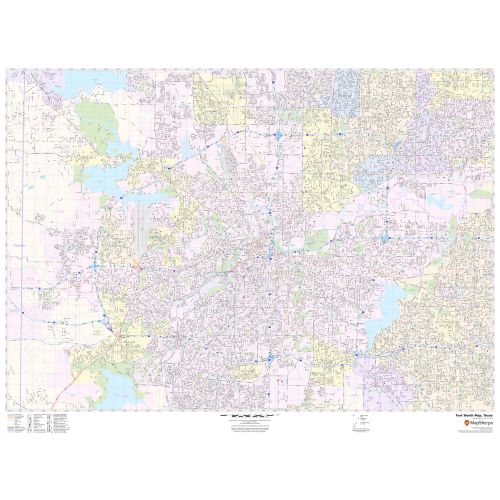
This map of Fort worth City has been designed with accuracy based on well-researched data. Transportation routes (I-30, I-820, SR-180, I-20, I-35-W) interlinking Cities of Texas, USA are marked neatly in the map with color-coded markings. The map highlights Municipal, town and ZIP code boundaries.
Details on the Map
The product has been designed to make custom maps suitable from City to County Scales, and anywhere in between. The map also depicts a high-level land use like parks, recreation areas, industrial areas, and hospital campuses. Major infrastructure like airports, police stations, shopping malls, industrial complexes, train stations is also identifiable. Railways, ferry routes, landmarks and a variety of major points of interest are included in the map.
The scale of the map is 1:27,000. The customizable map is available in landscape and portrait orientation. The title of your choice can also be added to the map. A map legend at the bottom helps identify all signs and symbols used on the map.
Uses of Map
Portrayed in subtle colors tones this map makes an attractive wall display in offices, educational institutions, business centers, and home study. The MapSherpa product is ideal for the business owner who needs a local or regional road network information within a service delivery, catchment area, or a sales territory. The elaborate road networks make this map an ideal tool for general reference and planning long-distance trips. The map's descriptive nature is clear and graspable which makes it apt for business and reference use.
Neighborhoods in Fort Worth, Texas
Neighborhoods in Fort Worth, Texas are divided into East, North, Northeast, Far North, West, and Central. The city's main neighborhoods districts are:
- Downtown Fort Worth is the central business district of Fort Worth, Texas, United States. Most of Fort Worth’s tallest buildings and skyscrapers are located downtown.
- The Fort Worth Stockyards is a National Historic District. The stockyard was once among the largest livestock market in the United States and played a vital role in the city’s early growth. Now this neighborhood has restaurants and bars.
- Upper Westside is District bound roughly by Henderson street to the east, the Trinity River to the west, Interstate 30 to the south while settlement Road to the north. The neighborhood contains several small and mid-sized office buildings and urban residences.
- Tanglewood consists of land in the low areas along the branch of Trinity River.
More information about Fort Worth, Texas
Fort Worth is the fifth-largest city in the U.S state of Texas. It is the county seat of Tarrant County, covering nearly 350 square miles (910 km2) into three other counties. Fort Worth is the second-largest city in the Dallas-Fort Worth-Arlington metropolitan area. Fort Worth is located in North Texas and has a generally humid subtropical climate. It is part of the Cross Timbers region, specifically Grand Prairie ecoregion within the Cross Timbers.
Since the 20th century, several major companies have been headquartered in Fort Worth including American Airlines, Cash America, and much more. The city is also the location of several University communities like Texas Christian University, Texas Wesleyan, University of North Texas Health Science Center, and Texas A&M University School of Law.
Zip and Area Codes Fort Worth, Texas
There are at least 51 Zip Codes in Fort Worth, Texas, all of which have a prefix of 76xxx. The Area codes of the City are 682 and 817.
More maps of Texas Cities
More Information
| SKU | svd_tx_fort_worth_48 |
|---|---|
| Map Scale | 1:27,000 |
| Flat Size | 36 x 48 in |
Reviews
{{title}}
{{detail}}