Mozambique
Details
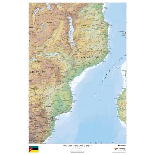
Mozambique Country Map
This detailed Mozambique map includes land information about the country’s political and physical features. Relief shading and different color hues used throughout the map depicts the height above sea level. You can view all major cities including the capital city, Maputo, and other surrounding places on the map. A small flag of the country is also featured at the bottom of the map.
You can buy this high-quality map of Mozambique in a selection of finishes that include paper, matte plastic, and laminate.
Where is Mozambique?
It is located on the southeast coast of Africa between latitudes 10° and 27°S and longitudes 30° and 41°E. Most of the country is a low-lying coastal belt with plateaus and highlands to the west.
It is divided into two topographical regions by the Zambezi River, the narrow coastal belt and highlands to the north and the low-lying land to the south. Major lakes in the country include Lake Niassa, Lake Chiuta, Lake Cahora Bassa and Lake Shirwa.
Major Cities in Mozambique
Below is a list of the 5 largest cities in the country by population. You can buy maps of all these cities by clicking on their respective names. Also, all these city maps are customizable, i.e you can center them around your preferred location and order them in various sizes and finishes.
Mozambique’s Neighboring Places
The country shares its border with a number of other countries and water bodies. You can find maps of all these places separately by clicking on their name below:
More Information
| SKU | dmsg-rel-mozambique-1 |
|---|---|
| Map Scale | 1:3,000,000 |
| Flat Size | 24 x 36 in |
| Publication Date | 2018 |
| Publisher Name | MapSherpa |
Reviews
{{title}}
{{detail}}