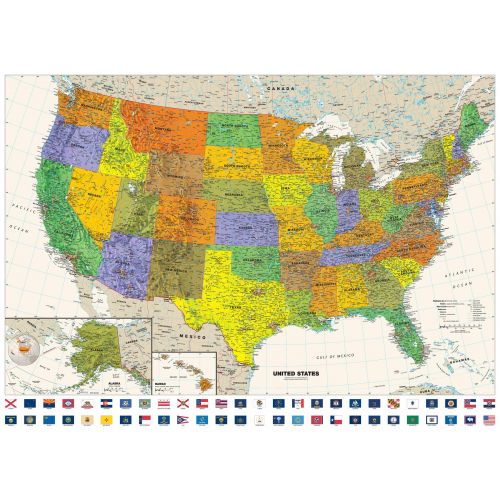
Map of USA States with Names
The USA Map of States is perfect for your home, office, or school decor. The map features flags combined with bright, attractive colors with high-detailed cartography. It also includes state boundaries, cities, major physical features like mountains, rivers, gulfs, Interstate highway system, and flags of all 50 states and the District of Columbia. This high-quality map uses the Albers Equal Area projection.
Details
Perfect for home, business, or school, this Contemporary USA Wall Map with Flags combines bright, attractive colors with high-detailed cartography. Details on this United States Wall Map include: state boundaries and capitals along with other major cities and towns; major physical features such as mountain ranges and major mountain peaks; major water features such as oceans, seas, gulfs, and rivers; the Interstate highway system and other major roads; all National Parks as well as other large National Park Service sites; and flags of all 50 states and the District of Columbia. Special features include ivory-colored oceans and a white decorative border. This map of the United States uses the Albers Equal Area projection.
More Information
| SKU | globeturner-GT008-CTP-USA-FL-16-1 |
|---|---|
| Map Scale | 1:4,000,000 |
| Flat Size | 50 x 36 in |
| Publication Date | 2016 |
| Publisher Name | Globe Turner |
Reviews
{{title}}
{{detail}}
No reviews yet ...
Have an opinion? Help others decide. Share your knowledge about this product by submitting a review.
{{/items}}
{{#previousPage}}
Previous Page
{{/previousPage}}
{{#load-more-src}}
Next Page
{{/load-more-src}}
★★★★★
★★★★★