Buffalo Map
Details
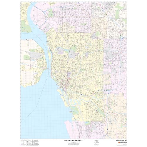
This map of Buffalo City has been made with precision based on well-researched reliable data. Lakes(Lake Erie), River (Niagara River) Transportation routes (I-190, U.S-62,U.S-20, U.S-219, NY-354) interlinking Cities of New York, USA are marked neatly in the map with color-coded markings. The map shows Municipal, town and Zip code boundaries.
Details on the Map
The map has been designed to make customized maps suitable from City to County Scales, and anywhere in between. The map also highlights high-level land use like a park, recreation areas(Buffalo Harbor State Park), industrial areas, and hospital campuses, Government Buildings, and more. Major infrastructure like airports, police stations, shopping malls, train stations(Buffalo-Depew), (Buffalo-Exchange Street) is also identifiable. Railways, ferry routes, landmarks and a variety of major points of interest are included in the map.
The customizable map is available in landscape and portrait orientation. The title of your choice can also be added to the map. A map legend at the bottom helps identify all signs and symbols used on the map.
Uses of Map
The map is presented in different colors makes an attractive wall display in offices, educational institutions, business centers, and home study. The product is ideal for the business owner who needs a local or regional road network information within a service delivery, catchment area or a sales territory. The detailed road networks make this map an ideal tool for general reference and planning trips. The map's explanatory nature is clear and graspable which makes it apt for business, travel and reference use.
About Buffalo, New York
Buffalo is the second-largest city in the U.S State of New York and the largest city in Western New York. The city is the county seat of Erie County and serves as a major gateway for commerce and travel across the Canadian border, forming part of the bi-national Buffalo Niagara Region and Buffalo-Niagara Falls metropolitan area.
The City’s early embrace of electric power led to the nickname ”The City of Light”. Buffalo’s economic sectors include industrial, light manufacturing, high technology, and services. Buffalo culture blends Northeastern and Midwestern traditions, with annual festivals including, Taste of Buffalo and Allentown Art Festival.
Location and Surrounding Areas near Buffalo, New York
Buffalo is on Lake Erie’s eastern end, opposite Fort Erie, Ontario, Canada. It is at the origin of the Niagara River, which flows northward over Niagara Falls and into Lake Ontario. Relative to downtown, the city is generally flat with exception of areas surrounding North and High Streets. The major cities surrounding Buffalo City are:
- Toronto- 90 miles(140 km)
- Rochester-74 miles(119 km)
- Syracuse-150 miles(240 km)
- Albany, New York State Capital, 288 miles(463 km)
- New York City, 375 miles(604 km)
Neighborhoods in Buffalo, New York
The city consists of 31 different neighborhoods. Buffalo’s most prominent neighborhoods are located in or near the downtown area, some of them are:
- J.N. Adam-AM&A Historic District is a national historic district
- Canalside
- Buffalo Niagara Medical Campus
- University Heights
Zip and Area Codes of Buffalo, New York
Buffalo roughly covers 44 ZIP codes. The ZIP code of the city ranges from 14201-14280. The Area code of the City is 716.
More Maps Of New York Cities
More Information
| SKU | svd_ny_buffalo_36 |
|---|---|
| Map Scale | 1:13,000 |
| Flat Size | 36 x 48 in |
Reviews
{{title}}
{{detail}}