North Miami FL, Map
Details
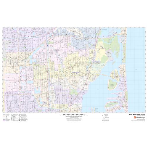
An interactive North Miami city Map shows street details with various landmarks (ThMuseum of Contemporary Art), government buildings, schools, churches, highways (I-95, U.S-1, SH-R-915), and more. The map also mentions municipal, Town, and Zip code boundaries. The map also shows hospital campuses, postal districts, streets and neighborhoods, industrial areas, and recreation areas like parks( Oleta River State Park), Golf courses, and much more.
Major infrastructure like airports, police stations, shopping malls, industrial complexes are also identifiable. A map legend featured at the bottom helps all the signs, characters, graphics, and symbols used throughout the map for better explanation.
About North Miami, Florida
North Miami is a suburban city located in northeast Miami-Dade County, Florida, United States, about 10 miles (16 km) north of Miami. The city lies on Biscayne Bay and hosts the Biscayne Bay Campus of Florida International University, and the North Miami campus of Johnson & Wales University. Originally the town of ”Arch Creek”, the area was incorporated as the ”Town of North Miami shores” which was later renamed and unincorporated as ”North Miami” in 1953.
Surrounding Areas near North Miami, Florida
- Golden Glades
- Sunny Isles Beach
- Westview
- Biscayne Bay
- Pinewood
More Maps Of Florida Cities
More Information
| SKU | svd_fl_north_miami_24 |
|---|---|
| Map Scale | 1:12k |
| Flat Size | 24 x 36 in |
Reviews
{{title}}
{{detail}}