Explore the routes followed by the principal explorers from 1497 up to 1905 on this map. Each route is marked as a red line, stating the name of the explorer or company, and when that person traveled along the route. This informative map also provides the dates of the founding principal forts and trading posts of the French, Hudson’s Bay and North West Companies.
The map is contained within the 1st Edition (1906) of the Atlas of Canada and can be of great referential value. You can gift this to your friends or buy one for your homes, offices, or schools.
Buy This Map
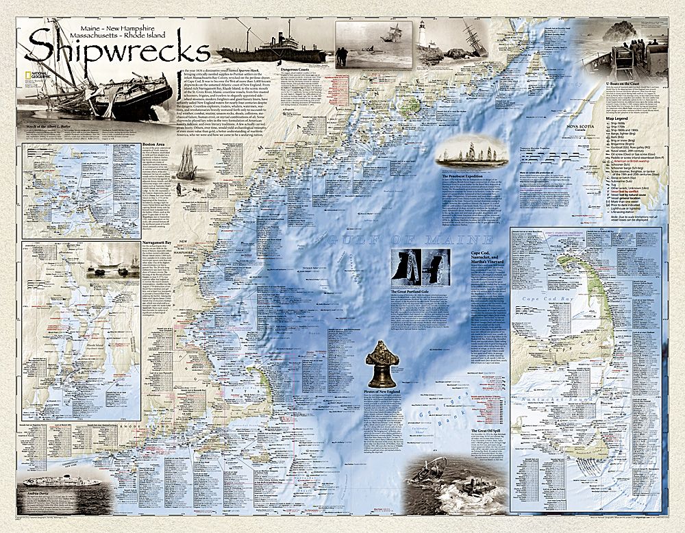
Shipwrecks of the Northeast Map
From $15.38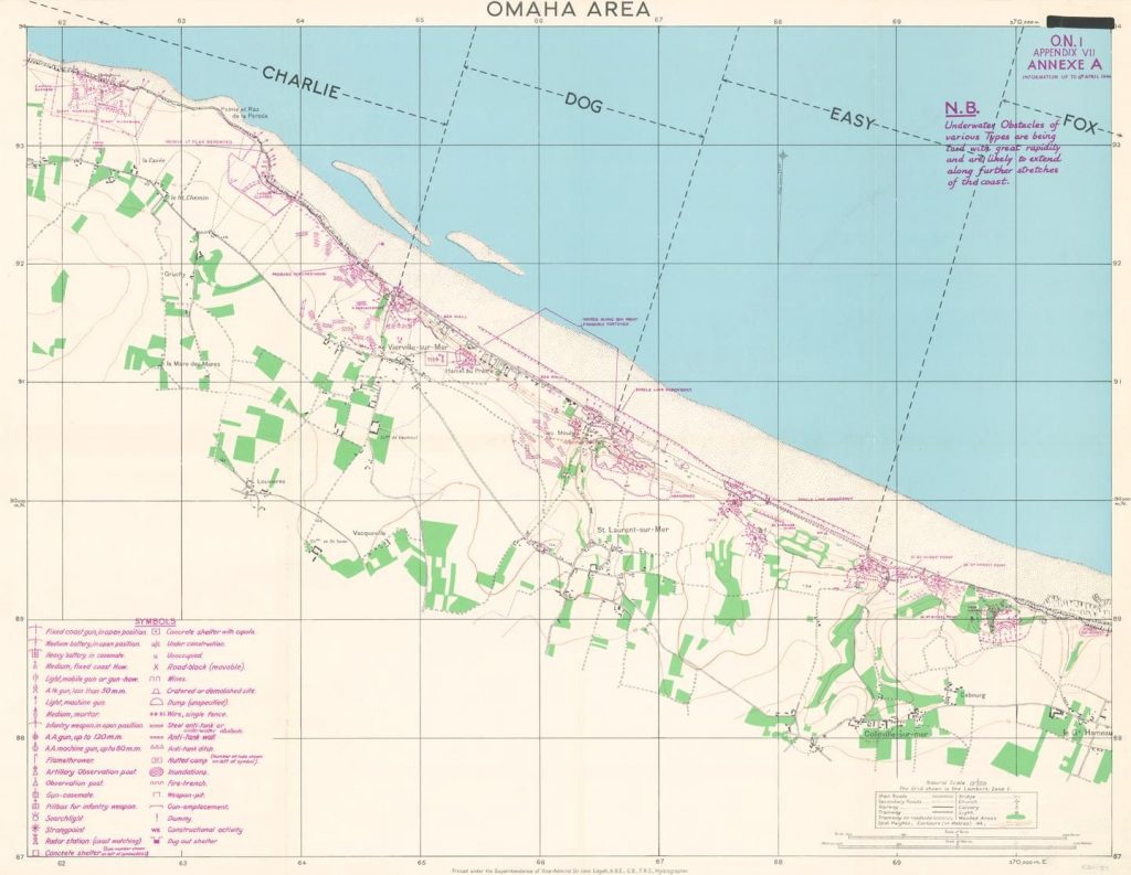
D-Day – Omaha Beach- Wall Map
From $23.07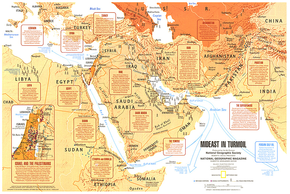
Mideast in Turmoil Map
From $16.92
