Coconut Creek FL, Map
Details
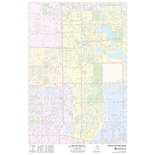
The Coconut Creek City, Florida has been made with accuracy based on the well-researched reliable data. The map depicts street details with landmarks, government buildings, shopping centers (The Promenade at Coconut Creek), schools, churches, Hospital Campus, airports, recreational parks (Butterfly World), (Coconut Creek Recreation Complex) and more.
The base map also features all the major roads and highways(I-95, U.S-441 SR-869, SR-827) and neighborhoods with names. A map legend at the bottom helps us identify all signs and symbols used on the map.
About Coconut Creek, Florida
Coconut Creek is a city in Broward County, Florida, United States. Situated 37 miles north of Miami, It is part of the Miami-Fort Lauderdale-West Palm Beach, Florida, Metropolitan Statistical Area. It is nicknamed Butterfly Capital of the World because it is home to the world’s largest butterfly aviary, Butterfly World, with over 80 species and 5,000 individual butterflies.
Cities and Municipalities Surrounding Coconut Creek, Florida
- North- Unincorporated Palm Beach County
- West- Parkland, Coral Springs and Margate
- East-Deerfield Beach
- Southeast-Pompano Beach
More Maps Of Florida Cities
More Information
| SKU | svd_fl_coconut_creek_24 |
|---|---|
| Map Scale | 1:14k |
| Flat Size | 24 x 36 in |
Reviews
{{title}}
{{detail}}