Wellington FL, Map
Details
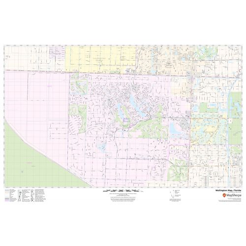
The detailed Wellington City Map shows Municipal, Town, and ZIP code boundaries as well. The major roads (Florida’s Turnpike) and highways( U.S-441, SR-7, SR-80), Beach, recreational parks(Essex Park) are easily identifiable on the map. A map legend at the bottom helps identify all signs and symbols used on the map.
Infrastructures such as hospitals, shopping malls (The Mall at Wellington Green), exhibition centers, industrial complexes, airports, and other business-centric features can be easily recognised on the map. The customizable map is available in various sizes, landscape and portrait orientation, and various premium finishes.
About Wellington, Florida
Wellington is a village just west palm Beach in central Palm Beach County and 66 miles north of Miami. Wellington is part of the Miami metropolitan area. Although Wellington is not a village under any standard definition of the term village in the US, it is referred to officially as the ”Village of Wellington”. The ZIP codes of the City are 33411,33414,33449 and 33467 and the area code is 561.
Parks and Recreation options in Wellington, Florida
The Village of Wellington has many parks, some of the popular ones are:
- Block Island Park
- Brampton Cove
- Margate park
- Berkshire Park
- Farmington park
- Patriot Memorial
More Maps Of Florida Cities
More Information
| SKU | svd_fl_wellington_24 |
|---|---|
| Map Scale | 1:19k |
| Flat Size | 24 x 36 in |
Reviews
{{title}}
{{detail}}