Miami Gardens FL, Map
Details
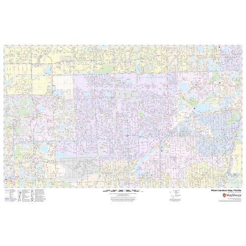
This map of Miami Gardens depicts street details (151 st Street), landmarks, government buildings, schools, churches, major routes (I-95), water bodies, street labeling, and much more. Information on the map also highlights Town and ZIP code boundaries.
The map also includes highway infrastructure including interchanges, weigh stations and tolls. Infrastructures such as Airport, Hospitals, shopping malls, exhibition centers, industrial complexes, and other business-centric features can be identified on the map.
About Miami Garden, Florida
Miami Garden is a City located in north-central Miami-Dade County, Florida, United States. It is 16 miles north of Downtown Miami. The City name comes from one of the major roadways through the area, Miami Gardens Drive. It is a principal city of the Miami metropolitan area. The surrounding areas bordering Miami Gardens area:
- Miramar(Broward County)
- West Park(Broward County)
- Miami Lakes
- Ives Estate
- North Miami Beach
- Ojus
Facts and Figures of Miami Garden, Florida
- Latitudinal and Longitudinal Coordinates-25.56’31.64” N 80.16’11.71” W
- Elevation- 7ft (2 m)
- Total Area-19.00 square miles(49.3km2)
- Zip Codes-33014,33054-33056,33152,33169
- Area Code-305,786
More Maps Of Florida Cities
More Information
| SKU | svd_fl_miami_gardens_24 |
|---|---|
| Map Scale | 1:14k |
| Flat Size | 24 x 36 in |
Reviews
{{title}}
{{detail}}