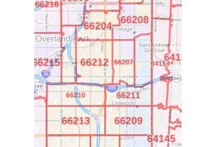
Kansas City ZIP Code Map, Kansas
This customizable Kansas City KS Zip Code Map includes extensive geographic details. It clearly marks all the 5 digit Zip Code areas using red boundaries. This map shows extensive geographic details. All the major roads and highways are labeled with grey and Blue lines respectively. Secondary and tertiary highways are demarcated by red and yellow lines respectively. The map also shows Interstate highways(I29, I35, I49, I70, I435, I635, I470, I670)
The base map also features ferry routes, railroads, land use such as parks, golf courses, recreation areas, industrial areas, hospital campuses, and postal districts. Important neighborhoods with names also featured on the map. Street with street names are mentioned at a detailed scale. A map legend featured at the bottom helps identify all signs and symbols used throughout the map.
The map is available in size 36x48inches.you can purchase this high-quality, customizable Kansas City KS, map in various finishes including paper, canvas, and lamination.
This map is available in a scale of 1:20,000 in 36 x 48 inches in portrait orientation. If you want a map with different extents, or landscape orientation, or scale, you can do that by customizing the map here. If you have any questions, we will be happy to answer over the phone (866) 525-2298 or write to us
Uses of Kansas City, KS Zip Code Map
This map can be used for various business functions including planning delivery, retail siting, sales region planning, and real estate. This map is also used for direct mail marketing via some companies. The elaborate road networks make this map an ideal tool for general references and planning long-distance trips.
Customization options available for the Map
We have a high-quality, customizable version of this map that can be centered around any area of your choice. Logistic and service delivery businesses can also use these maps for cropping their service delivery area maps from the base maps. Holiday home/cottage owners can create customized maps with the location of their holiday home and cropping the area to order a customized map poster for their wall.
Zip Codes of Kansas City
Kansas City, Missouri is associated with roughly 71. Zip Codes by the US Postal service. It ranges from 64101-64199,64999. The USPS has segmented the country into 10 Zip Code areas starting from Northeast, they are numbered 0-9. The next two numbers of the Zip code are assigned according to the city. And the last two digits represent the area of the city or town. These Zip Codes are used in the city for efficient delivery services, statistics, direct mail marketing, Internet routing, and credit card security.
Information about Kansas City, Missouri
Kansas City is the largest city in the U.S state of Missouri by area and population. It is the most populated municipality and the historic core city of the Kansas City metropolitan area. Most of the City lies within Jackson County and Wyandotte County in Kansas. The city is composed of several neighborhoods, including the River Market District in the north, Vine District in the east, and the Country Club Plaza in the south. Kansas City, Missouri, comprises more than 240 neighborhoods.
The city has an area of 319.03 square miles(826.28km2), of which, 314.95sqare miles(815.72km2) is land and 4.08 aware miles(10.57km2) is water.
More maps of the Kansas City, Missouri
- Kansas City, Missouri Inner Metro-portrait Map:This portrait-oriented map of central Kansas, Missouri shows detailed street-level information including extensive street labeling.
- Kansas City, Missouri Inner metro- landscape Map:This landscape-oriented map of central Kansas, Missouri shows detailed street-level information.
- Map of Kansas:This colorful, easy to read state map of Kansas identifies all major thoroughfares, landmarks, and more.
Visit the online store of Maptrove.ca for more options.
| SKU | svd_kansascity_ks |
|---|---|
| Flat Size | 36 x 48 in |
| Publisher Name | MapSherpa |


-
![Kansas City, MO Map]() Kansas City, MO MapPrice from $32.99
Kansas City, MO MapPrice from $32.99 -
![Overland Park, KS Map]() Overland Park, KS MapPrice from $32.99
Overland Park, KS MapPrice from $32.99 -
![Kansas City, KS Map]() Kansas City, KS Map$32.99
Kansas City, KS Map$32.99 -
![Shawnee, KS Map]() Shawnee, KS MapPrice from $24.99
Shawnee, KS MapPrice from $24.99 -
![Lenexa, KS Map]() Lenexa, KS MapPrice from $24.99
Lenexa, KS MapPrice from $24.99 -
![Overland Park ZIP Code Map, Kansas]() Overland Park ZIP Code Map, KansasPrice from $41.99
Overland Park ZIP Code Map, KansasPrice from $41.99


